
12 Feb Tropical Storm Basyang Slows Down While Moving Westward
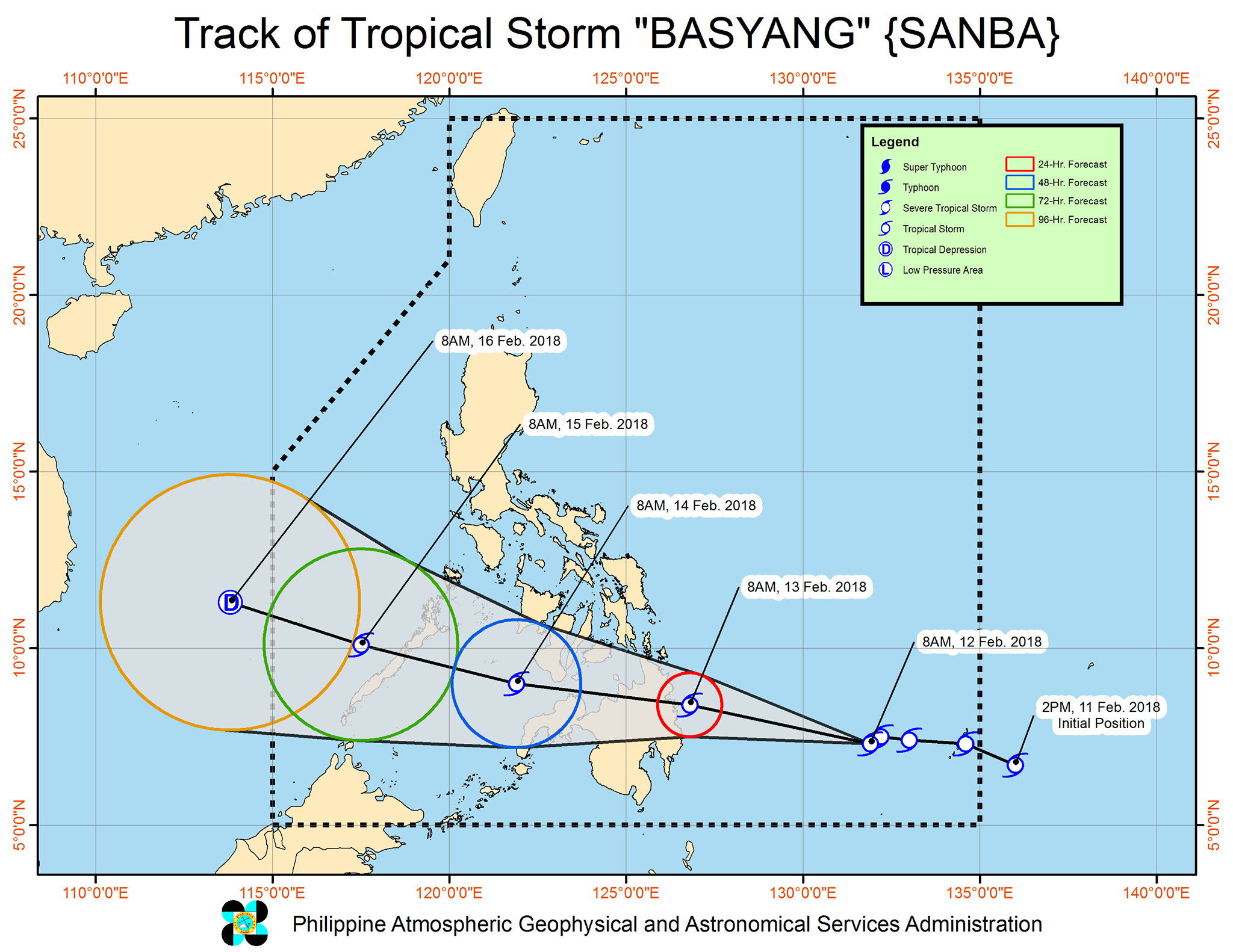
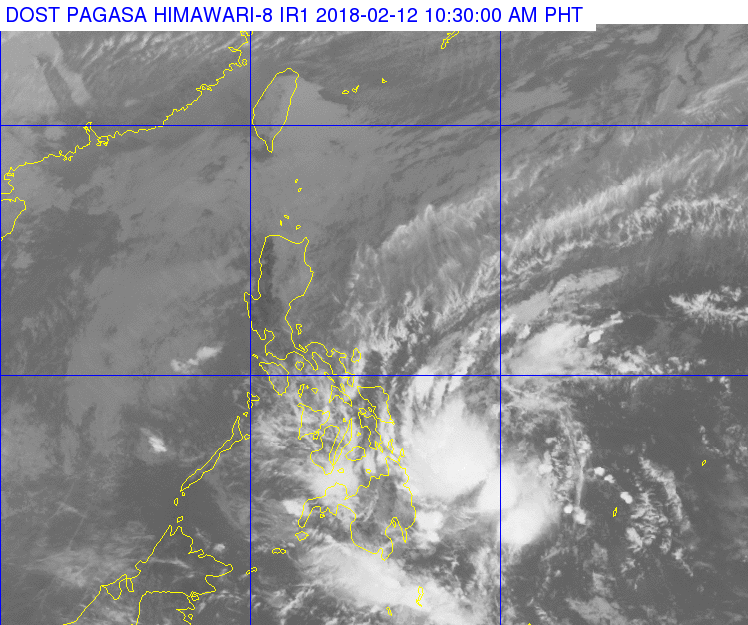
As of 11:00 am, PAG-ASA has updated their monitoring for Tropical Storm Basyang currently located at East Southeast of Hinatuan, Surigao del Sur. The storm has maximum sustained winds of 65 kph near the center and gustiness of up to 80 kph. It is currently moving West Northwest at 22 kph.
Forecast Positions:
24 Hour(Tomorrow morning): 55 km East of Hinatuan, Surigao del Sur(8.4°N, 126.8°E)
48 Hour(Wednesday morning):160 km West Southwest of Dumaguete City, Negros Oriental(9.0°N, 121.9°E)
72 Hour(Thursday morning): 145 km West Northwest of Puerto Princesa City, Palawan(10.1°N, 117.5°E)
96 Hour(Friday morning):50 km Northwest of Pagasa Island, Palawan (OUTSIDE PAR)(11.3°N, 113.8°E)
TROPICAL CYCLONE WARNING SIGNAL:
TCWS#2 (61-120kph expected in 24 hrs):
Surigao del Sur, Wave Height: (Open Sea) 4.1-14.0 meters Storm surge possible at coastal areas
TCWS#1 (30-60kph expected in 36 hrs):
Southern portion of Samar, southern portion of Eastern Samar, Leyte, Southern Leyte, Bohol, Cebu, Negros Oriental and Siquijor Dinagat Islands, Surigao del Norte, Agusan del Norte, Agusan del Sur, Camiguin, Compostela Valley, Davao Oriental, Davao del Norte, Misamis Oriental, Misamis Occidental, Lanao del Norte, Lanao del Sur, Bukidnon, and northern portion of Zamboanga del Norte
Wave Height: (Open Sea) 1.25-4.0 meters
The public and the disaster risk reduction and management councils in concerned areas are advised to take appropriate actions and watch for the next Severe Weather Bulletin to be issued at 2 PM today.
Source: DOST_PAGASA

No Comments