
27 Jun History Of The First Bridge In Cagayan de Oro City (City of Bridges)
With just one search using Bridge in Cagayan de Oro City thru Google one can already see the number of bridges that serves as connecting roads from the West part of Cagayan de Oro, to the East.
What makes this more interesting is that these bridges are not that far apart from each other. In fact, from one bridge in Cagayan de Oro City to another, a drone can be used to cross, even with its range limits.
Bridges in Cagayan de Oro City
The First Bridge
But like every collection, there needs to be a first.
So what is the first bridge in Cagayan de Oro City? We’ll answer that with a little history.
According to Fr. Francisco Demetrio S.J., in his book entitled “Cagayan”, the first bridge in Cagayan de Oro City was built in what we now know as Ysalina Bridge (Or Carmen Bridge), and it was a bit unstable and made of Bamboo at first. It was built around 1888-1890 by the labeled “Bridge Builder” Major Juan Zanon, a military governor of the Misamis Province.
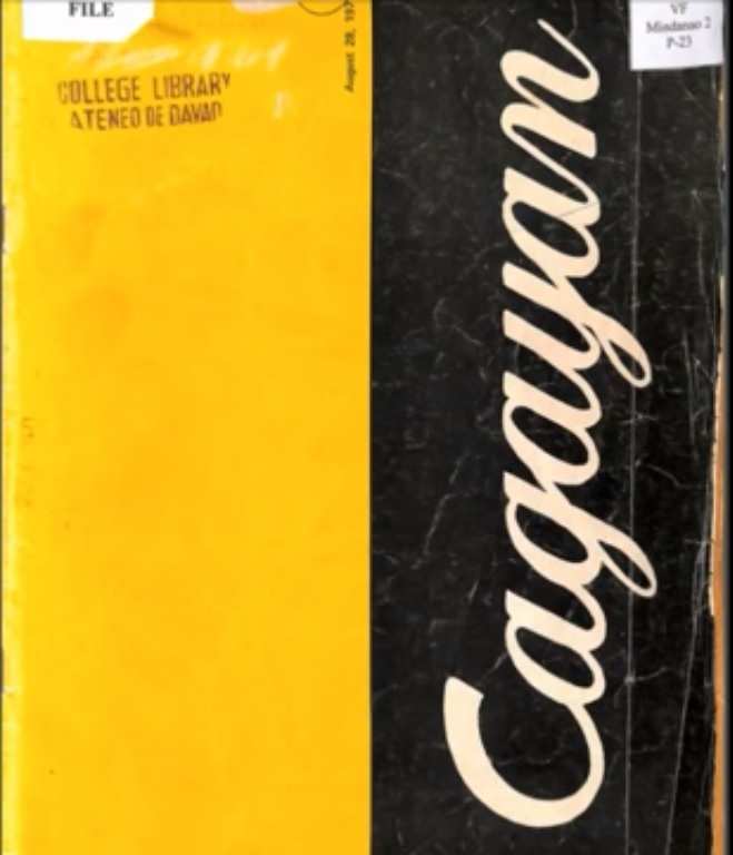
Fr. Francisco Demetrio S.J.Book – “Cagayan”
Hanging Bridge
Not long after, they found a need to built a stronger and more stable bridge as more and more found a great use for faster means of transport crossing the river, and also given our frequent visits of strong winds and bad weather. From bamboo, Carmen Bridge was then reconstructed to carry a better design and structure and became a hanging (or suspension) bridge, as inspired from one of the hanging bridges in Claveria.

Puente del General Blanco Hanging Bridge – Cagayan de Oro
The 128 Meters long hanging bridge was named “Puente del General Blanco” after incumbent General Ramon Blanco y Erenas (Governor and Captain-General from 1893 to 1896.)
The said bridge in Cagayan de Oro City was paid by donations from several local families, with P5,000 in gold coins, and was built to be the longest suspension bridge in the Philippines at one point.
Reconstructions
From then on, several improvements have been made, making it a suspension bridge to a fully concrete bridge as seen on the famous inauguration photo dated August 26, 1931. (photo below)

Ysalina Bridge (Carmen Bridge – Reconstruction) – Source: Kagay-an Kaniadto FB Page
If you ask locals, a lot of them will say that the bridge has kept its original form, but actually one major reconstruction was made after the war. (See photo Above).
Passing by this famous bridge in Cagayan de Oro City, it will be hard to notice the difference, but the top foundation has actually been reconstructed and improved for durability and appearance purposes. From the previous Flat Top design that the bridge carries, a more stable Curved Top has been made as part of the reconstruction.
City of Bridges?
Now flash forward 86 years and we now have 8 bridges in Cagayan de Oro City in just one strip (not including the other bridges along the city).
That’s 8 bridges in between 9.66 km
I guess that makes Cagayan de Oro a likely candidate for the title “City of Bridges”.
Do you agree?

Bill Wrinkle
Posted at 05:16h, 28 JuneThis article is mistaken. The first bridge was located in a completely different part of CDO, as shown in the aerial picture linked to here: http://primaveracity.italpinas.com/wp-content/uploads/199633_10151047835542972_860922109_n.jpg In this photo from 1930 you will see the original General Blanco bridge located just to the north of the eventual location of the bridge on J.R. Borja (starting actually what is now Yacapin street). You can also see the Gov Ysalina Bridge being built in this picture in its present location close to Gaston Park. As you can see, one bridge may have replaced the other, but they were not remotely close to each other, and thus your conclusion that the bridge near Gaston Park was CDO’s first bridge is completely erroneous.
Coy
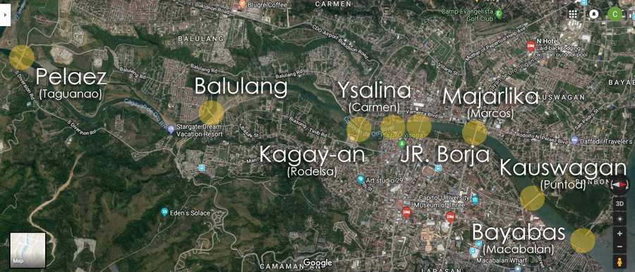
Posted at 07:24h, 28 JuneHi Bill. Thanks for the info. Based on our research, from the book “Cagayan”, the first bridge was built around 1888-1890 by Major Juan Zanon. The bridge under construction, from the photo you provided (1930) may already be the 2nd reconstruction of Ysalina Bridge. Though we honestly can’t verify this, we just based our info on our short research.
By the way, we took the liberty of checking the photo you sent and matched it with the current map of CDO (https://imgur.com/a/QWZawdu), and we believe the bridge you were referring to is the same bridge as the Ysalina Bridge. We may be wrong, but we enjoyed learning more about our history as well. We appreciate your concern and efforts, and we thank you for sharing.
Bill Wrinkle
Posted at 07:01h, 29 JuneGood lord. This is a bit embarrassing to have to explain to you, but you do realize that you have been looking at the maps upside down from each other without realizing it? Here… look at the maps with both facing the same direction, and you might notice your mistake. https://imgur.com/OJ7MsiP